Category Archives: 2022 Via Gebennensis
On The Road Again
It’s been 3 years since the Wirewalker crew last attempted a European walk. One pandemic and a number of health issues took their toll, but we’re back at it again.
Some background: About 8 years ago (2014), Diane and Bill did their first walk in Europe, the Camino Frances, from St. Jean Pied de Port (France) to Santiago de Compostela (Spain). That 500 mile walk was beautiful and addicting! So, in 2016 we did a second walk, from Irun, Spain to Santiago … and then on to Finnesterre and Muxia (western-most part of Spain). Another 600 miles. 2018 took us to France, where we walked from Le Puy en Velay to our original starting point, St Jean Pied de Port!
2019 took us off course a bit, into Italy, walking the Via Francigena in Italy, from Lucca to Rome.
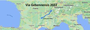
And now we’re back! This year, we intend to “connect dots”, traveling from Geneva, Switzerland to Le Puy en Velay.
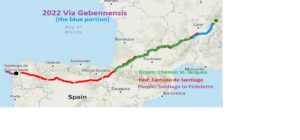
Here’s a map of the various journeys (not including Italy):
So, now we’re on our way! First stop was LA, a commute hop to catch our Iberia flight to Geneva. Diane and Bill use this time to get adjusted to International dining by feasting on fine offerings of Rubios!
Next stop, Geneva! Our plan is to spend three days there, then start the walk through to France.
Au Revoir!
Nous Sommes Arrivés a Geneve
A long day of travel, but no major hiccups … therefore, successful!
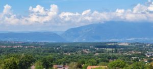
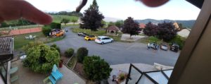
Before describing the journey, let’s jump to the finish line. Here’s the view from our hotel balcony !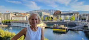
In the background are the Swiss Alps and in the foreground, the Rhone River. About 200 yards to Diane’s right is Lake Geneva! We’re okay with this view!
The flight from LAX to Madrid was long, 10+ hours, but nice. We had 90 minutes in Madrid to clear immigration, security, then find out terminal/ gate, but again, no problem.
Once in Geneva, we took a bus/metro to the hotel (easier, thanks to very helpful locals), and now we’re here!
Tonight we sleep well, then tomorrow begin exploring this beautiful city!
A bientot
Chores and Explores in Geneva
Both Thursday and Friday this week were all about chores and explores. Each day included 10+ miles of walking, but nothing yet towards our goal of finishing in France. That starts tomorrow!
Chores: While doing these walks, we travel with only our backpacks; clothing, toiletries, some food, etc. We also bring a suitcase, which we ship ahead to the most convenient end-of-hiking location. When we arrive to our suitcase, it’s like Christmas … new clothes, etc. In this case, our ship-ahead location is Carcassonne, France. This is normally surprisingly easy as multiple services will pick-up and ship your bags … except in Switzerland, which is kind of, but not really, part of the European Union. That issue limited our choices, but fortunately, the Swiss Post Office came to the rescue! While more expensive than other traditional approaches (hey, Switzerland never was cheap) , the service was very efficient and the bag is on it’s way!
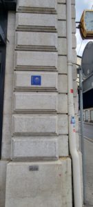
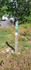
The second chore was to determine where the Via Gebennensis markers are! About 30 minutes of looking, we found two. Here’s one:
We hope to be as lucky in finding the next few thousand we need to stay on our chosen path!
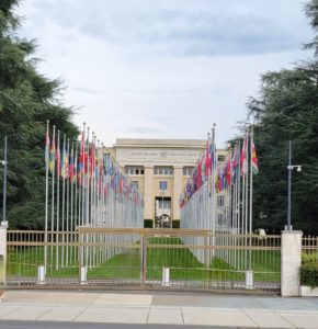
Explores: Geneva is the world headquarters of just about everything; the United Nations,
Red Cross, World Health Organization, the World Trade Organization,
embassies and much more!
There’s also the Alps (Mont Blanc in the far background)
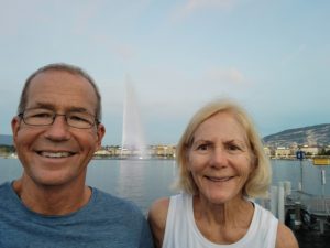
And, Geneva’s famous Jet d’eau, climbing 500′ in the air!
And so, tomorrow we start to walk! The Via Gebennensis is not a common walk for English speakers. The only guidebook we could find is bilingual; that is, bilingual French and German! No English! What’s an adventure without adventure, eh?🤔.
A demain, nos amis!
Day 1: Geneve to Mt Sion
We’re on our way! 16 miles and 2200′ of climbing brings us to the outer edge of the Lake Geneva valley and our rest stop for day one!
We started early out of our hotel
Following a trail through a major city is really challenging as the trail markers are inconspicuous (at best) and can be rare. Nonetheless, we made it out of town without getting lost (yippee)!
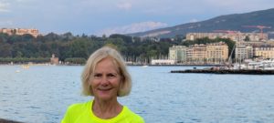
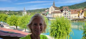
Fifteen miles later, we closed in on our rest stop. Here a photo of Diane with Lake Geneva in the background.
If you look carefully over her right shoulder (zoom in), you can actually see the water jet spout in Lake Geneva. You’d think that after 6 1/2 hours of walking we’d be further along. Oh well.
There’s so much to talk about in this first day, but … we’re actually a bit beat, so we’ll save those items for another day.
We’ll leave you with some photos from the day’s hike. Until tomorrow …
Au revoir!
Day 2: Perdu (Lost)!, and Encounters
Today was 13 miles, with 2,000′ of ascent, giving us 29 miles and 4,200′ of climbing, total.
The morning started well, misty and cool with the well-marked trail right across the road from our night’s stay! Awesome!
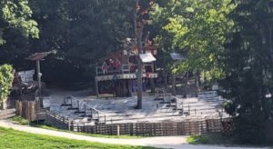
We walked for 2 miles, enjoying the quiet, the beauty and each other. Our plan was to stop in the village of Charly, just after 2 miles to see if we can find a small store to get some snacks. What we didn’t notice was that 100 yards before Charly, our desired trail (we think) turned right … away from Charly! Oops! We walked into town (nothing open) and continued following “signs’ for another mile, steeply descending, until we “ran out of trail” at a medival amusement park! This doesn’t look right!
Not good! Stopping for about 15′ to figure out where we went wrong, along with Google maps, Bill figured alternate way to intersect with the trail. Two miles of paves roads later
We were back on the trail! So, how did it happen? Eagerness to get to “the town’ was a factor. We weren’t looking diligently enough to see an indication that our trail turned.
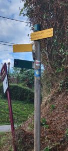
The second factor was confusing signs. The “scallop shell” is the official sign for our path, but our path is also known as “4” for the first 30 miles of so. Also, multiple city, regional and French national trails join our trail for a period of time then disappear. You can get lulled into thinking that those signs will “always” lead you to the right place. Here’s a typical sign post:
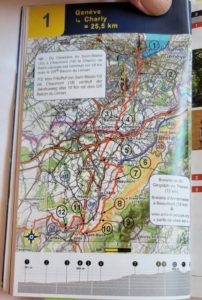
The final factor is the approach the guidebook uses; mostly focused on facilities available in different towns, rather than course directions. Here’s an example of today’s path. Pretty limited on details:
Ultimately, the biggest factor was the first; you simply have to pay attention all the times to where you’re going!
At the end of it all, getting lost is just a story. The real value in these trips are the beauty you see, the dedicated time with your hiking partner (spouse), and the people you meet on the way!
There were the Brits, in a Lotus car club, doing a circumnavigation of France in 10 days. Interesting stories!
The German couple also walking the Via Gebennensis. Actually, the only other trekkers we’ve seen, so far.
The British ex-pat cyclist who stopped to have a chat with us.
And of course, the numerous hosts we’ve had the pleasure to talk with while they suffer through our French.
There is no better way to get to know a nation, or region, or lifestyle, than taking the time to talk and listen. We’ve been blessed!
Chaumont to Seyssel; Down the Lazy River
Today was 12 miles walked and 1,300’climbed for journey totals of 41 miles walked and 5,500′ climbed … so far.
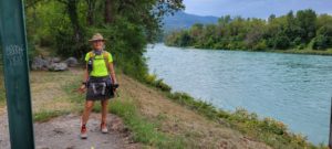
The more things change, the more they remain the same … In Geneva, we took this picture of Diane on our balcony overlooking the very beginning of the Rhone River.
Three days later, we’re back on the Rhone, in Seyssel, with Diane on our balcony …
This may become a theme as we continue westward!
Similarly, on our first day of hiking, we snapped a photo of an interesting canyon in the distance to the west, as:
Today, that canyon is to our East, as:
So, that’s what 41 miles of walking buys you, a different perspective!
Yesterday afternoon, after we made it to our day’s stop, we took a hike to the top of a nearby hill. Amazing views! While it will likely not do justice to the true view, here’s a photo of Mont Blanc from that hilltop.
It’s been a good day. Cleaning, eating and resting await. Bis spater.
Seyssel to Chanaz: The detour
Today was 15 miles walked, with 500′ of climbing. Our totals are now: 56 miles walked, and 6,000′ climbed.
Our stay by the river yesterday was beautiful …
as was much of our walk today along the river.
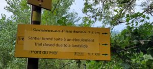
About 8 miles into the walk, we encountered this sign
“Detour, landslide! ” Okay, we’ll go around! It added another couple of miles to the walk, but it got us to where we were going, Chanaz.
Chanaz is s very nice tourist town, bustling with, well, tourists 🤔!
We saw two fellow peregrinos today. Chris, from Munich, who started his walk in Munich! He’s covering 25 to 30 miles a day and intends to finish on Santiago, 1200 miles later, in mid October. WOW! Then there was Carolyn, a single female hiker from North Carolina, who is walking from the border of Italy to Le Puy, about 500 miles in length.
We’re happy with our 250 mille journey. We may be slow, but we’re out here!
Take care, A demain!
Chanaz to Yennes; Beauty and the Beast
Today was 11 miles walked, 1600′ climbed, for totals of: 67 miles walked and 7,600′ climbed.
This is a beautiful party of the world! We can easily use all of our superlatives and still be at a loss to describe the beauty.
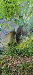
There was the watermill on the way out of Chanaz
The view from the ridge:
And hiking along the river:
And the clear signs that Fall is just around the corner:
How can we not enjoy this? We are, but there is a beast (not really a beast, but I needed something to go with “Beauty”) …
This Via Gebennensis is well marked and mostly of very good trail quality. But, it’s not popular … yet. (We saw no other hikers today). That’s good and bad. Good for the quiet enjoyment of the trail beauty, but a challenge for support and resources. Where on many trails, food and water stops are plentiful, here … not so much. So planning ahead for the next day or two’s meals needs is a requirement. Finding stores that are open and nearby for that meal planning is the next challenge. Today, we walked 2 miles to stock up for tomorrow’s longer hike.
It’s really not a big deal, but you can get run down after 6 or so hours of hiking and become grumbly about “more work. Truth is, we’ve been blessed and are thankful for enough health to do the journeys.
Bonne journee!
St Genix to St Ondras; Walking Through Europe
Today was 14 miles and 1,700′ of climbing. Totals are: 96 miles hike and 12,000′ of climbing.
A cool day for hiking as rain was projected off and on through the day. No rain, but lots of cloud cover to keep us cool.
So, what’s it like hiking in Europe? In the US, we have backpacking, which is done on remote trails, usually quite a distance from civilization. You bring your own food and you sleep where you lay your bedding.
In Europe, the countryside is laced with trails going every which way.
Some trails are 20 minute lunch loops, some afternoon hike, and some go clear across the continent … like the one we’re on.
And unlike the US trail system, no trail is ever more than a few miles from the next town, cafe, etc.
That leads to a very popular pastime here of vacation trekking; going from village to village, hiking during the day and sleeping in nicer accommodations at night. Very civilized!
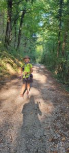
So, what about the trails? The routes place highest priority in dirt or gravel paths
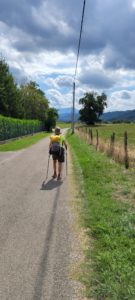
Next in preference seems to be remote, paved roads
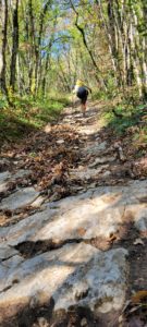
Then single-track (sometimes sketchy)
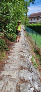
And sometimes, just bizarre, like this “wall walk” that we had to do for about 150 feet.
And the last choice, though used sometimes, are the busier paved roads
Often, to avoid the busier roads, that trail signs will direct you 90⁰ or even 180⁰ opposite from the town you’re headed to, in order to use a farm path or a dirt trail. It’s really okay as we never were in a race to get from one place to another.
Enjoy your path!
