All posts by Bill-Di Pinbert

Last Night in Le Puy

Okay, on Sunday evening, before our Monday start, we found out that there were more of the large scale Le Puy projections. Recall the prior post where we showed the projections onto the massive Le Puy church? Well, they’ve done it one better! Onto an isolated rocky spire (250′ high) where an old church is built, they project an AMAZING video production. On it, the spire becomes a live volcano, spewing lava and forming the spire. Then dragons come (hey, why not? ), then men. Over time, the church is built on the spire by hauling materials up by pullies, etc. Wars, winters and celebrations then follow. It looks remarkably real!

We took several short videos, but none of them came out with any real quality (sorry). Nonetheless, we still post one to give you an idea.

No doubt, a short search in google or YouTube will provide better videos but, hey, we were there.

Le Premier Jour: Le Puy to St. Privat d’Allier

Day one, done! Well, actually Day 2 is also done but we had some major trouble with the internet yesterday.

Day one: We chose to start the day by attending the Pilgrim’s service at 7:00am. Though we are not Catholic, it would be truly a loss to not attend this beautiful service to send off the Pilgrims. It has been done for a thousand years before. We attended and we’re blessed. Definitely worthwhile.

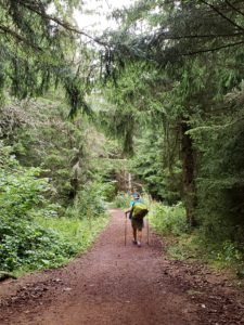
The hike was 15 miles of winding up and down through some very beautiful French countryside. 

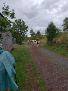
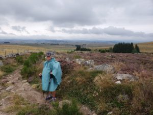
Oh, and it did rain. Maybe 90 minutes. Enough to require the rain gear, but nothing to cause problems.

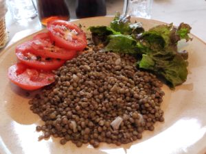
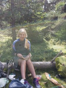
In the Le Puy region, famous for lentils, every meal will have lentils. Here’s our lunch on the way: 

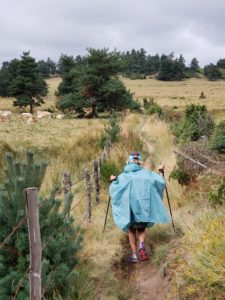
And with a full stomach, more hiking: 

And then we arrived! Laundry, food (including lentils) and sleep awaited.


St. Privat d’Allier to Sauges

Another day, another 12 miles, for a total of 27 miles to date. Today was stunningly beautiful! The countryside was spectacular, the weather was accommodating, and the food was, well a picnic!

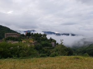
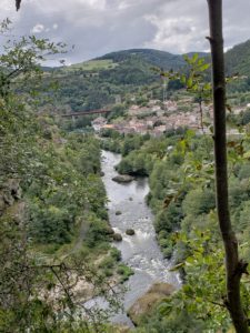
Here are some shots of the countryside:

While difficult to see without expanding the image, the second bridge (the smaller one) was built by Gustaf Eiffel. Also, just moments before we took this picture several groups of rafters passed down the river.

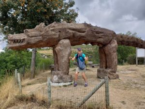
On arrival into Sauges, we were greeted by this wooden carving of the Beast of Givaudan. The wolf was responsible (reportedly) for killing over 100 people during a three year period in the 1700’s. Bill actually remembers reading the story as a kid.  Well, here’s where it happened. 

Dinner and sleep await!  More tomorrow!

Sauges to Les Faux

Le troisieme jour! Today was 17 miles, bringing our total to 44 miles for the trip. It is again interesting to speak in feet, gallons, pounds and farenheit to our friends and family and speak in meters, liters, kilograms and celcius to everyone here. We not only translate the French, but also measurement systems. Such is the life …

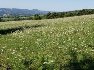
Today’s journey took us across the ridges of the Margeride mountains, between 4,000 and 4,500 feet. The countryside had a bit of the alpine meadows feel to it.

A better example of the countryside can be seen in our “lunch stop” photo, below. 

There is more to talk about, the numbers of hikers on the trail is starting to drop, the adventures of some of our fellow hikers, etc., but the internet is poor so we will keep this post short.

Bon Journee!

Les Faux to Aumont-Aubrac: Planning, Pace and Pain

Bonjour! Aujourd’hui est le quatrieme jour. Today was 13 miles, bringing the total to 57 miles.

Once again, this region of France is stunning! We’ll start with photos then go to the story. 
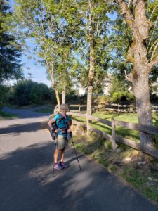
And of course, your classic French log cabin with grass growing on the roof and horses grazing in the front …
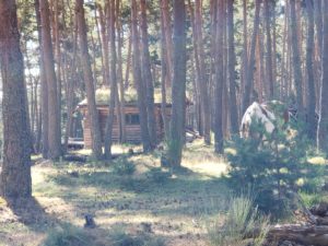
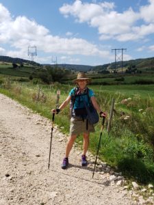
And then there’s this section of trail that really felt s lot like we were hiking in Yosemite.
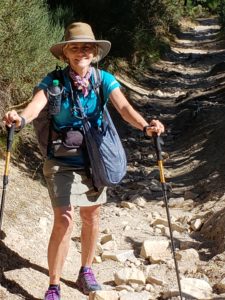
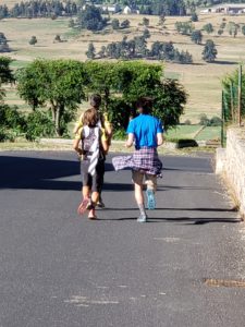
Also, not a day goes by when we don’t see this French couple. They RUN every segment, every day. Today, they had a friend join them (the guy on the right, in the blue).
Now, back to the title: planning, pace and pain. This is now our third major walk (more than 30 days on the trail) and there are some things that we are a bit tuned into. You start with a plan: “I want to do this or that”, and “I’d like to do it in this many days”. Okay, you now have the beginnings of a plan.

To accomplish that, you need a “pace”, this many miles per day, on average, etc. But, each day probably requires a bit more fine tuning, like: We need to be there before dark and we have do many hours to hike… therefore a pace of ‘this’ is required.

Then there’s pain. No matter your plan, or your desired pace, pain will set your actual pace, and therefore, your plan.  The first couple of days, you are excited and fresh and can take on the world! By day 3 or 4, the adrenaline is gone and the aches appear … this is the beginning of the toughest period. This is when you ask yourself,  “what am I doing? ” This period passes, but not overnight. For us, it can last 5 – 7 or more days. It’s that … just hang in there period, where you keep saying “it’ll get better”.

The reality good news for us is that we now know that it always gets better … just wait. We’re in that valley now, but the beauty, great food, excellent learning and a spot of patience all helps to see us through.

God bless.
Aumont-aubrac to Montgros: Signs on the Chemin

Today was about 15 miles, bringing our total to 72.

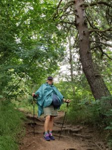
When you do a journey like this, you cannot help but meet people … and people from all over. There are the four Australians, a very friendly group. Many groups of French; some with 5 day plans and some with several week plans.  There are hikers from Canada, Japan and even Nepal! Each has a story and if you take the time, you might be able to hear them!
The hike today was, well, beautiful … again. Today seemed a bit like the high plains of Nebraska or South Dakota, as: 
And, 

The altitude is about 3,500 to 4,000′, helping to give the landscape a bit of the Alpine meadows feel

Four years ago, when we did the Camino Frances, we did a post on “Finding Your Way on the Way”. So, how different is it in France? Well, not much!

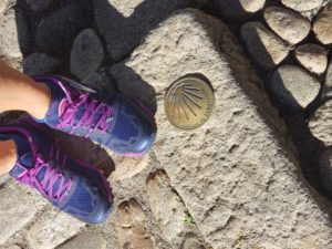
Here’s the first signpost as you leave the cathedral in Le Puy: 

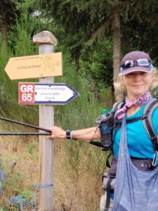
Sometimes, they are formal signs: 

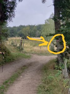
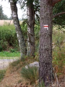
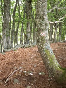
Most often, they are “white over red” stripes that indicate the Chemin (way) and are found on trees: 

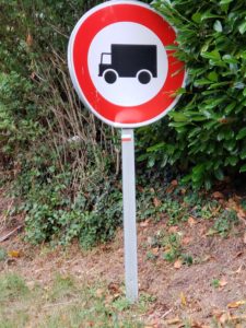
On road signs: 

And on rocks, fences, roofs, and about anything that doesn’t fly away.

When they want to indicate a turn, they show it on the Red and White sign, as: 

When they want you not to go a certain way, they use the Red and White lines to form an “X”, meaning ‘don’t go this way! ‘

Overall signs on the Chemin are pretty good!

Montgros to St. Chely d’aubrac

Today was another 12 miles, bringing the 6 day total to 84 miles … about the distance from Danville to Sacramento.

We continue to meet very interesting people on the trail! There is a German couple that started the Camino by walking out their door in Germany. Each year, they walk a few more weeks, and several hundred kilometers,  to progress closer and closer to Santiago. There are several women who are walking solo. They seem to quickly build a support network amongst themselves and  are able to relax a bit more while doing the walk.

So, the walk! Today we crossed over the highest point of the plateau we’ve been on, and hit about 4700′ in elevation. 

As we crossed over, we got our first view of the Lot River valley, where we will be hiking for the next couple weeks. 

We also traveled through the village of Aubrac, which seemed to be the coffee shop destination of choice for every pilgrim within 50 kms!

And, to assure all that we are keeping a philosophical mindset while walking, here is some French philosophy to consider (the translation is left to the reader).

We hope all are well back home.

St. Chely d’aubrac to St. Côme d’Olt

Another 10 miles completed bringing us to 94 miles walked on this trip.

Many of the guide books consider St. Côme as a lunch  stop and recommend hikers to continue another 4 miles down the road or so. For us, this is a beautiful place to stop for the night … so here we are! Below is a photo of the ancient church here with the famous ‘twisted’ steeple. 

Let’s back up a bit. Last night, we stayed in St. Chely, a very charming village half the way between the heights of the Aubrac plateau and the Lot River valley. Here is the view of St. Chely on leaving the town. 

For dinner, we had the “demi-pension”, or the ‘included’ meal. Again, very nice. The surprise was the entertainment … the 8 year old daughter who decided she was using the restaurant to debut her career!  She presented a skit she developed, sang a few songs and did a bit of dancing. It reminded us of a Kimmy- created play, and a Calyn and Nora performed singing and dancing number!  Sorry, Ben, Jenna and Hayden. We didn’t see a part for you in this production. Perhaps in the next village?

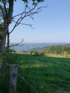
The views and the hiking were beautiful, as we continued to descend from the high plateau to the river valley. 

In fact, over the last two days, we have dropped over 3,000′ in elevation. The rapid climb of daytime high temperatures confirms that we are more toward the low lands.

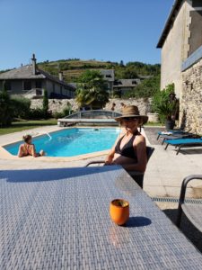
On arrival to St. Côme d’Olt, we were treated to something we hadn’t yet seen in this journey, a swimming pool! Talk about the right way to relax after 5 hours of hiking!

Ahhh, this is the life! 12 more miles of hiking tomorrow and then … another swimming pool!

St. Côme to Estaing; Frankly Speaking

Today was a beautiful walk, about half of which was on the River Lot. It was a 13 mile walk, bringing our total to 107 miles.

Leaving the medieval city of St. Côme requires our first of many crossings of the Lot river. 

From there, we climbed abruptly to an escarpment that overlooks both St. Côme and the next town along the way,  Espalion. We tried to capture the panoramic view with a video. Hopefully, this works:

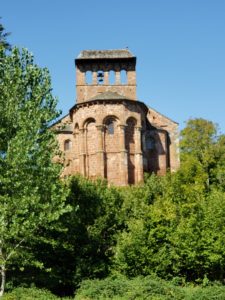
On the descent down to the next village,  Espalion, we passed an ancient Persian church, dating back to the 10th century. 

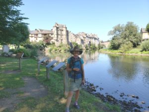
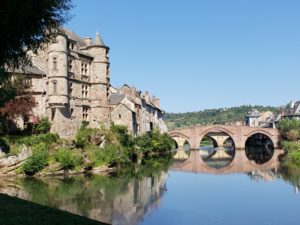
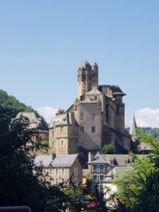
Espalion was, yep, another beautiful village. Here are photos of the river with the town in the background.On arrival into Estaing, we were not disappointed. The village is considered one of the most beautiful in France and is the home of former French prime minister, Valery Giscard d’Estaing (note the “estaing” part of his name! )

Now, what’s this Frankly speaking thing? Well, from the onset of this journey, we have tried to use as much French as possible, to build our very modest skills here. What we have found is that many of the French people were met are much more fluent in English than we are in French.

In short order, they quickly direct the conversation to English. We suspect two possible reasons for this quick transition to English:

1. They feel so badly for us that they want to put us out of our misery as quickly as possible, or;

2. They are proud of the French language and can only suffer so much abuse of their native tongue before they must act … so they move us off of French!

Actually, when we talk them that we’re really do want to learn French and that we will only get better (hopefully) by practice, almost universally they become very helpful teachers of the French language. Very cool.

Enough for now. This is the second place in all of our Camino journeys that had a pool. We must partake!

Aujourd’hui, un Pause; Reflections

Today, there were no miles walked. We took a pause, a break. What a unique experience, waking up when you wish, not packing your backpack, eating, then hitting the road! Our only chore was to find coffee, and lots of it!

Like true hiking addicts, we quickly found ourselves walking tomorrow’s hike for about 2 miles before returning to Estaing. We can quit anytime, right? Just not today!

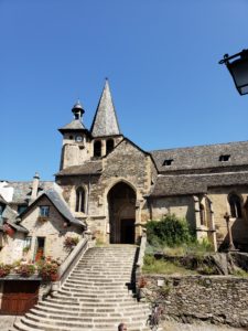
Every small village has it’s cathedral, like Estaing.

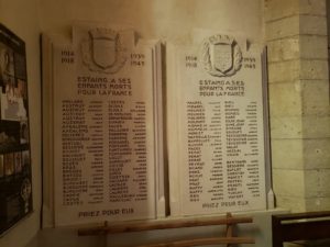
They are always beautiful and almost always 1,000 years old. And in every village we come to, there is a plaque like this: 

It’s a list of those who died fighting World War 1 or WW2. Two things are striking. First, the sheer number of casualties for such a small village (a village of a couple hundred might have 30 casualties) and second, the disproportionate numbers of fatalities in WW1 vs. WW2.

I had a great conversation with a Frenchman about this. His response was that, in WW1, the invading German army was held north of Paris for nearly 2 years and many, many Frenchmen died defending that line. In WW2, the Germans literally rolled into the country and there was no front line! It was over.  The French were either an occupied nation (northern half), or a controlled nation (southern half). There weren’t as many fatalities because the fighting ended so quickly.

My friend noted that, only after D-day were the French able to actively engage in the battle again.

He also talked a bit about the challenge of actively resisting during the occupation. When your family, your village, and your livelihood is constantly at risk, decisions to resist are more difficult. He talked also of those who took risks to hide Jews during this time, another very grave risk.

You can always learn something, at any age.  Whether it is a new language or the history of your host. It just requires slowing down a bit to listen.  That isn’t all that easy. We’re still working on it.

You are each in our thoughts and prayers.