Monthly Archives: September 2022

St Genix to St Ondras; Walking Through Europe

Today was 14 miles and 1,700′ of climbing. Totals are:  96 miles hike and 12,000′ of climbing.

A cool day for hiking as rain was projected off and on through the day. No rain, but lots of cloud cover to keep us cool.

So, what’s it like hiking in Europe? In the US, we have backpacking, which is done on remote trails, usually quite a distance from civilization.  You bring your own food and you sleep where you lay your bedding.

In Europe, the countryside is laced with trails going every which way.

Some trails are 20 minute lunch loops, some afternoon hike, and some go clear across the continent … like the one we’re on.

And unlike the US trail system, no trail is ever more than a few miles from the next town, cafe, etc.

That leads to a very popular pastime here of vacation trekking; going from village to village, hiking during the day and sleeping in nicer accommodations at night. Very civilized!

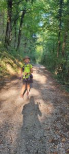
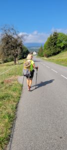
So, what about the trails? The routes place highest priority in dirt or gravel paths

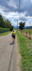
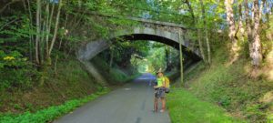
Next in preference seems to be remote, paved roads

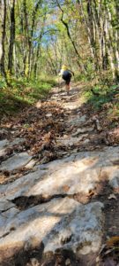
Then single-track (sometimes sketchy)

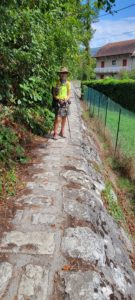
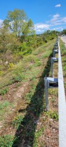
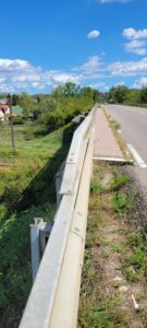
And sometimes,  just bizarre, like this “wall walk” that we had to do for about 150 feet.

And the last choice, though used sometimes, are the busier paved roads

Often, to avoid the busier roads, that trail signs will direct you 90⁰ or even 180⁰ opposite from the town you’re headed to, in order to use a farm path or a dirt trail.  It’s really okay as we never were in a race to get from one place to another.

Enjoy your path!

Yenne to St Genix: Fire and Rain

Today was 15 miles walked and 2,700′ climbed.  Our 6 day totals are:  82 miles walked and 10,300′ climbed. Tomorrow will be a rest day.

On arriving yesterday into Yenne, we did our usual routine;  find a store (that’s open), shop for food for the next morning and lunch, go to our hotel, B&B, or Gite, shower, wash clothes, route plan for the next day, update the blog, then dinner. After dinner, we try to take a walk to identify where the trail starts the next day.  It’s our routine.

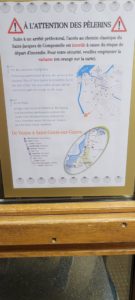
So, on our after dinner walk, we got to the next day’s route marker, we found this sign:

Here’s the translation: Hey, Pilgrim! We’ve closed your trail for the 12 kilometers because of FIRE danger. But don’t worry, the map on the bottom of the page shows you an alternate route!

If you look very carefully at the route they show a route: and if you can figure where the trail is … you’re better than us!

Next thought:  What if we claimed we don’t speak French and do the original trail, anyways?  Darn, their sign is also in English! Okay, where is this “alternate”?

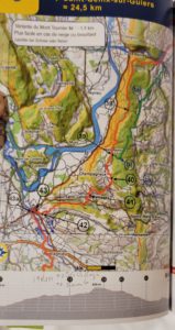
Bill remembered that, in our guidebook, they show a “variant”. On the photo below, the variant is the GREEN line, versus the ORANGE line for the original.

Okay,  not easy to read, but … at least it means that there’s a MARKED variant trail somewhere for us to find! Now, where to find the start of that variant?

Once again, that guidebook that Bill was discrediting came to the rescue! On the “resources” page, they state the the variant starts on the “corner opposite the Fer du Rhone hotel”. Hey, that’s where we’re staying! A quick trip outside and we see the variant marking. BINGO!  We’re on our way.

Rain: The issue with Fire danger is that Central Europe has had a dry summer. Typically, it’ll rain here every 5 – 7 days,  then get hot,  then rain, etc. This summer, the “rain” part was missing. As a result, there were several fires in Spain and Western France. As a precaution, some areas restricted access to minimize risks, like our current location.

Well, about 3 weeks ago the rain returned. Since we’ve been here, we’ve had 3 GOOD downpours. All that should mean that the risks are lower and the closed areas, reopened. Not so. Particularly since there’s only a couple of Pilgrims per day doing this trek. Hardly worth removing a whole bunch of signs. So, the detour remained!

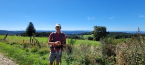
Now, the walk was beautiful  … as always:

Two noteworthy items.  While hiking up a long, steep road,  we saw this painted on the road:

If you follow Pro cycling,  you would know that the current world champion is a Frenchman named Julian Alaphilippe. His adoring French fans call him “Loulou”! So, this writing on the road (very common practice by fans of cycling) was put there to encourage Loulou, who must have been racing there! Cool!

Next, we finally saw a Pilgrim who was moving slower than us …

All for now. Tomorrow is a planned rest day for us. Stay well.


St Ondras to Le Grand Lampe; Ascent, Grade and Surface

16 miles and 2,400′ of climbing today.  Trip totals are:  112 miles walked and 14,400′ climbed.

Last night, we stayed at a very charming B&B, Le Pas de l’Ane (donkey step), which was beautiful, had a great breakfast, but no dinner.  If you had a car, there are restaurants 5 or so miles away … but we are on foot and just walked 15 miles.

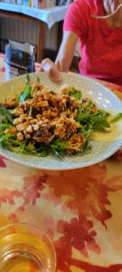
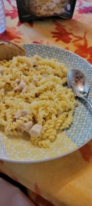
So, knowing that we needed our own food, we carried freeze-dried backpacking food! Sounds questionable, eh?  It actually turned out well, with Diane adding some arugola for flair and both of us adding some excellent French bread. Here are the photos:

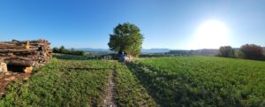
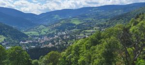
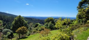
Today’s hike was beautiful, here’s a sample:

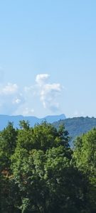
And, a beautiful Sunday morning “cross” cloud.

Now, on to today’s topic: Ascent, Grade and Surface. When we look at how far we want to walk, we try to keep the day’s climbing under 2,000′. Sometimes it’s easy, Sometimes not so much! In our planning, we figured that today’s stage would be 2,000′, +/-. We didn’t figure that last night’s stay was about 0.75 miles off our trail, and 200′ drop in elevation. Those numbers had to be “undone” to even start today’s stage.

And once again, today’s stop was 0.5 miles of the trail and … 200′ of additional climbing.  Oh well.

Now, not all ascent is the same.  From Yenne to St Genix, we climbed 2,000′ very gradually, making it hardly noticeable.

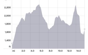
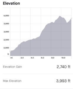
Other times, like today, we had a 600′ section that went “straight up”, then went “straight down”. Here’s the Strava elevation profile of the stage.  You can see the spike I’m talking about, below:


That kind of “ascent” can hurt!

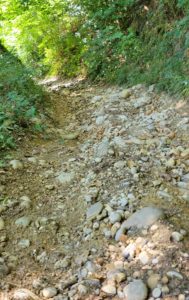
Now, Surface:  if the ground is firm and smooth, it’s a whole lot easier to walk up (or down) than if it’s slippery. The worst is slippery and rocky, where the stones just roll under your feet as you try to step down. The last decent was slippery and rocky:

The grade was > 25%! It was tough!  We traveled about  1 mile/ hr on that stretch.

All for now. Laundry and dining await!

La Grande Lampe to Cote St Andres; French Connections

Today was 9 miles walked and 700′ climbed. An easier day to bring in a tougher week ahead. Our totals are 121 miles walked and 15,100′ of ascent.

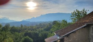
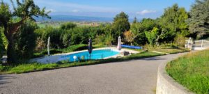
We stayed last night in a “converted garage-cum-B&B , without the second ‘B'”! Wonderful hosts, modest accommodations.  The view from their place, however, was amazing!

And, they did have a pool to cool the toes!

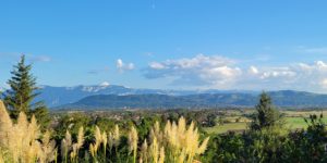
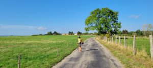
The walk today was mostly along the base of a ridgeline, following a very long valley.

We have 2 or 3 days of this, then we start seriously climbing. We’ll hit about 4,000′ in altitude on Saturdsy … so enjoy the flats while you can!

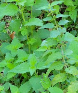
A short note; while the scenery is universally beautiful, it’s not always friendly! This plant

(Stinging nettle) is very common in this area. There are also large varieties that can branch across the trail and snag the unwary Pilgrim (yelp!). We’ve learned to be careful …

French Connections: Here in the countryside, it’s a lot easier to meet people and have conversations. While our French is still miserable (even after 5 years of working on it) we have had good fortune to meet patient French people, who seem genuinely pleased to meet and talk with an American. Just people talking with people. This is one of the reasons we’ve so enjoyed these Caminos; people to people sharing.

We’ve also met Thierry and Elaine, two fellow Pilgrims from France. The friendliest folks you’ll meet. He’s a Harley rider when he’s not hiking (and has the tatoo to prove it!).

They’re walking about our pace, so we see them with regularity and they’re headed to Le Puy, so we should see them some more.

I should note that they are 2 of only 6 Pilgrims we’ve seen in 10 days in the trail.  We’re okay with that.

Au revoir


Cote St Andres to Primarette; Deja Vu

Today was 16 miles walked,  1,300′ climbed for a running total of 137 miles walked and 16,400′ climbed!

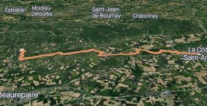
Today’s path, like yesterday’s (and the next couple days)  follow a very long valley from the foot of the Alps, to the east,  to the Rhone River (yep, well see that again)  and the beginning of the next mountain range to the west,  the Massif Central.

Strava provides a great satellite graphic of today’s hike, as:

Pretty cool, eh?

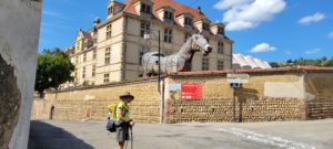
Going through valleys are nice, but are less “dynamic” than the mountains.  So, what did we see?  A Trojan Horse! (It was empty this time).

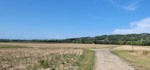
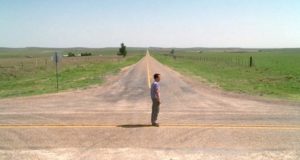
While walking through a plowed-over cornfield, the both of us had a deja vu experience; we’ve seen this thing before!

Here we are in the middle of literally nowhere, and there’s a direction sign giving you choices.

(You’ve got to look closely but there a very formal direction sign in the middle of this cornfield intersection! ).

I guess if you go left, you will go to cornfields, but if you choose right, you will also go to cornfields! Hmm, which way to go?🤔

Both of us immediately thought of the final scene in “Castaway”, where Tom Hanks stood at a similar role intersection and ponder where to go …

For us, we chose “go right”, mostly because that was our Camino direction.

Hope all are well!

Day 11: Primarette to St Romaine

Today was 11 miles walked and 1,000′ climbed. The running totals are 148 miles walked in this trip and 17,400′ climbed.

We are certainly hearing of the hot, hot weather back home.  Our hearts go out to those of you suffering through that.

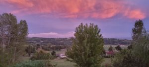
Here, the weather is transitioning, from Summer to Fall. The rain storms have been mostly reserved for evening hours, but are extending more and more into daytime, hiking hours.  It still can be beautiful, as this photo from our place last night shows:

Today, the rain started just after we arrived at our current place!  Tomorrow,  we will likely start out in rain.

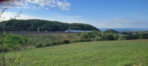
At one point, we needed to cross under the TGV  high-speed train tracks that run from Avignon to Lyon.

(You can see the train in the center of the photo, above).

It occurred to us that we had actually taken that train, on these tracks, 4 years ago! We had just finished language lessons near Nice and took this train as part of our trip to Le Puy en Velay… the continuation of this hike which we did in 2018! Who’d of thunk we would hike under those tracks, 4 years later?

Tomorrow we finish at the Rhone … after 6 days away from it.  It continues to be a fascinating journey!

Stay cool!


Day 12: St Romaine to Chavanay, the Rhone and Strange Trails!

Today was 13 miles and 1,000′ of climbing. Totals are:  161 miles walked and 18,400′ climbed.

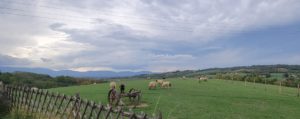
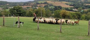
Last night, our stay was at a farm; sheep, horses, dogs, the whole bit. It was beautiful,

And we even watched as the owner was training a new sheepdog!

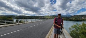
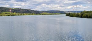
So today we walked back to and across the Rhone, which is now about 160 miles from its source at Lake Geneva!

And at this point, it truly is a mighty river

And now for strange trails!

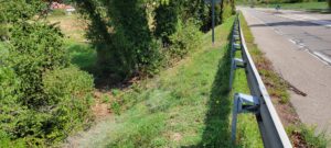
The path needed to cross another high-speed train track.  The only convenient crossing was a well congested highway overcrossing … not a super- safe option.

So, the path led us through an orchard, right up to the highway embankment, that we needed to scramble up … with backpacks.

Once up to the highway, or job was to walk inside of the guardrail to the overpass.

Once we arrived at the overpass itself, we needed to climb over the guardrail towards the street-side and use the small sidewalk that exists, but only for the overpass itself.

Once across that overpass, you need to climb back inside the guardrail (because there’s no longer a sidewalk)  and continue down.

And thus, we cross the train tracks!

Actually, they used the self- same method to get us up to and across the bridge crossing the Rhone.

Always an adventure 😁!

Au Revoir

Day 13: Chavanay to Bourg-Argental; Over the River and Through the Woods

18 miles hiked today, with 3,200′ of climbing. Totals are:  179 miles hiked and 21, 600′ climbed.

Yesterday was “over the river” and today was certainly “through the woods”! (and orchards and streams, etc!)

We left Chavanay and began climbing immediately. In short order, the view of the Rhone, far below, was fantastic!

We also met the seventh Pilgrim we’ve seen on these 170+ miles of hiking.  He’s an Austrian, going from Geneva to Le Puy.

We also met multiple day hikers, couples and single hikers, all French, who were very friendly and allowed us to work our simple French with them!  It’s really a great way to get to know a people, with these easy, unrushed conversations.

On multiple occasions, we found ourselves (as Daniel Boone used to say)  “mighty misplaced”! Actually, not bad, but … As we walked along, there would be places where  fire roads, or farm roads, or goat paths, etc would intersect.  One of these paths was the one  you arrived on, one  would be the correct path to leave on, and two or three others that are just plain “there”, the wrong path. This intersecting situation happens with some frequency, and the correct choice is usually well marked. Today, not so much.

On several occasions we had to “pick a path” commit to it for about a 1/4 mile and search for trail marks. If no success, go back and try another approach. 2 or 3 times today, we had to use that approach!

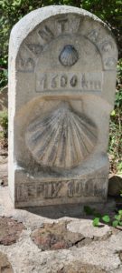
So, about 1/2 way through today’s stage was saw this sign:

It’s a sign indicating “only 1,600 km to Santiago”. That’s 1,000 miles for us Yanks. It also says “100 km to Le Puy” (62 miles) . So what’s interesting is that we have walked all of that 1,000 miles (less the 62 mi) on prior hikes!  Plus the 170 miles back to Geneva!

After a long day of hiking, we arrived in Bourg-Argental, our rest for TWO nights.

We arrived a bit late, but our host was gracious. He occupied himself by working on his toy!

Laundry, showers and searching for food await.

Toute a l’heure!


Rest Day: Miam Miam DoDo?

Today is the second rest day of our journey.  Our chief planner (Diane) artfully scheduled this after a long stage (18 miles, 3200′ of climbing)  and our next shorter, but steep climbing stage (probably 11 miles and 3000′ of climbing). Well done, Diane!

Miam miam dodo? It is French “child-speak” (and also the title of a French guidebook). Miam miam is how the French spell “Yum-yum” and means “food”.

Dodo is a contraction of “dormir”, to sleep.  Thus,  dodo means sleeping!

So, how do we eat and sleep on this Camino?

On the more popular walks, places to eat and sleep are easily found. Because there are more hikers, there are more services. Because there are more services, there are more hikers.

This trail (Geneva to Le Puy) is stunningly beautiful, but sparce in hikers and services. We noted that we’ve seen only 7 other Pilgrims (hikers) in 2 weeks of  walking.  For comparison, on the Camino Frances we would see 50 – 250/day. On the Del Norte Camino, maybe 20 – 25 a day.  Here, it’s less than 1/day. That means services will NOT be geared to Pilgrims.

A couple of other notes.  This trail goes through a remote section of France, with lots of very small villages that have no boulangerie or store or restaurant. Nothing.  That has to be part of your planning.

Also, given that we are hikers (no car) who probably just did 6 or more hours of hiking that day, we are likely NOT going to walk 5 miles to an open restaurant in another town!

The other challenge,  which we’ve heard from multiple French people, is the social/ employment effects of the pandemic.  The first is getting your employees back.  The second is getting services back.  Benefits for unemployment and business support are still available here in France, so getting workers (and even some businesses)  back can be a challenge.

All that really matters to us is that services are currently harder to come by on this journey than pre-pandemic.

What is clear is that you can’t solve the “Dodo” problem without considering the “Miam miam” problem.

So let’s talk about the options available, then we’ll talk about how those played out on our hiking, so far.

As we are typing this on a phone (very tedious) , it won’t have all the nice details, links or pictures, but hopefully will help. If you look up the location and name of the places we list below on Google maps, you will see lots of photos of those places. Maybe at a later date, we’ll pull photos and insert them into this post.

Dodo: So,  what are the options?

Hotel: In bigger villages, that is possible. Ideally, there is a restaurant at that hotel (that’s open … not always the case! ) or a nearby restaurant (that’s open).

Apartment/ house to rent:  Very comfortable, but a food source is needed.

B&B: Nice room, with bedroom, bathroom and breakfast. Sometimes dinner is available.

Gite: Sort of a hostel, but can have private bedroom or shared bathroom. These are actually well distributed throughout our journey, but we prefer to have our own “space” (bathroom, bedroom).

Accueille Jacquaire: These are rooms in a private home made available to Pilgrims on a “donation” basis. Dinner and breakfast are included.  We’ve never stayed in one, but our French friends have and thoroughly enjoyed them!

Camping: Sort of.  There are campgrounds with permanent RV’s, Yurts or tents available to rent. Again, we’ve never done that, but our friends have.

While there are more options, that covers 99% of them.

Miam Miam: What about eating?

First, some background. In France, most (almost all) businesses close on Sunday and Monday. You really have to think through your food plans on Friday and Saturday or you will find yourself rather hungry for a couple days!

Restaurant: Always a good choice, if they are open and close enough to walk to.  Another consideration is price. Usually, the restaurants are fairly priced, but sometimes they can be pricey. Given that we are “eating out” three meals a day for a month or so … it better be an outstanding restaurant to justify a high price.

Bar: Bars here are like Diners or cafe shops back home.

Grocery Stores: Most of our breakfasts and lunches come from this route. Some dinners come from this source.

Demi-Pension: Many of the above types of Dodo’s can provide a Demi-pension. That means dinner plus breakfast. On this route, there were far fewer that provided the demi-pension than we’ve seen in the past.

Freeze-dried backpacker food! Yes, you read that right! We carried two evening’s worth of backpacking food … and have used them both!  There are some places where it is very difficult to find a good supply.

With that as background, let’s walk through our stays, so far:

Geneva: We stayed in a hotel,  Les Tournelles. Great location on the Rhone, close to downtown and the start of the Camino. Food came from restaurants and a nearby grocery store with a fantastic delicatessen.  We stocked up there on snacks (energy bars, etc).

Mt Sion:  We stayed in a hotel, Hotel The Originals,  next to “Santa’s village”. Seriously!  They had a restaurant which provided dinner and breakfast, but not lunch. As there was no store or restaurant on the way, we used our Geneva supplies for lunch the next day.

Chaumont: A rented home (450 sq ft). “La Famile Revillon”. Remote location. We purchased an abbreviated dinner (lots of which had just been picked from the garden.  Diane was in heaven as there were lots of tomatoes.) from the proprietors, but were on our own for breakfast.

Seyssel: Nice hotel (Logis Hotel du Rhone), with local restaurants and stores.  We had to take a trail variant to reach this place and follow the Rhone to the main trail 3 km further down the river.

Chanaz: Restaurant/ B&B (Le Doux Nid). Dinner and breakfast at restaurant, a local store for lunch supplies.

Yenne: Another hotel (Hotel de Fer a Cheval).  The proprietor wasn’t there when we arrived, they were out playing since WE would be the only guests that night. Dinner and breakfast were at the hotel, lunch from a store.

St Genix. B&B (Le Maison Fleure de Frangipanier) . Christophe, the proprietor,  was an eccentric, but kind and extremely talented host.  He has worked as a sommelier at a 3 star Michelin restaurant and works winters as restaurant director at a Swiss Alps ski resort.  Very good food!

St Ondras: B&B … very nice (Le Pas de l’Ane).  No dinner anywhere nearby. We used the first of our backpack meals here!

La Grande Lampe ( Le Mas Dauphinois): B&B without the second “B”. Really nice hosts.  Room was a converted garage with silk sheets! No restaurants open, anywhere. Host took us to a “pizza vending machine” for our dinner. 😒

St. Andres: A hotel (Hotel de l’Europe) straight out of “the Shining”. It was the only game in town, seriously.  The other hotel actually closed on Sunday and Monday.! The proprietors were very nice though.

Primerette: Gite (private room, shared bathroom) (Chambres au Grand Calme). As there were no other guests, the bathroom was all ours. Dinner and breakfast included.

St Romain: Cottage rental on farm (Une Pause Sur la Coline). Nice location,  on a working farm,  but no services,  and a lot of farm flies!  We used our second freeze-dried meals here.

Chavanay: Another Gite .(Le Pigeonnier) Dinner and breakfast provided.

Bourg-Argental: Two- bedroom apartment (Le Square) in the downtown of a beautiful village with lots of resources and a super host! We hit the jackpot with this stopover!

Booking: About half of these were booked on Booking.com, and the rest using guidebooks and the internet (and Google Translate!)  Diane does research, looking at ratings and reviews.  Most times, we are content, but on occasion we get a unique surprise or two.  And that’s part of the adventure!

Americans in France: It’s probably worth noting that on this trail, in this part of France, there aren’t many Americans. While we met one American woman hiker early on,  we’ve been told by our hosts and others that they don’t often see Americans. Their reception of us, however, has been phenomenal! Americans are well liked in this area (we’ve even heard the “thank you for helping France out in WWII” story).  We have been introduced to neighbors, friends and even had others call friends/ family to say “they’ve met Americans”. It’s actually pretty heartwarming!

All for now,  Bill and Diane.
Day 14: Bourg-Argental to Les Setoux

Today was 12 miles of hiking and 2,700′ of climbing. Totals for the journey are:  191 mi hiked and 24,300′ climbed.

We’re starting to get up in elevation! Two days ago, we were at the Rhone, 500′ above sea level. Today, we hit 4,000′ of elevation!

And the views? Top of the world!

The journey, while definitely uphill, was also spectacular!

Our stay in Bourg-Argental was perfect, a medium sized village with enough supplies for us to restock, while still remaining charming.

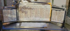
And, of course, like all the villages we’ve visited in France, they had their war memorial.

Two things:  For us in the United States, the World Wars were tragic and many of our citizens died. But the war was never in our backyards or fields or towns. Here in France (like the Ukraine today), the war was in your face, in your 24 hour-a-day life.

The other thing to notice is that All of the names on the 3 vertical plaques are deceased from World War I. The small horizontal plaque in the foreground lists all the deceased from World War II. I asked about that in s previous trip and was told that, in WWI, there was a battleline between Germany and France for years and so many French (and German) soldiers died defending that line.
In WWII, Germany was much more ‘efficient’ and rolled through France before any defense could be mustered. From that point on, the French losses were only those in the “underground” resistance.
Enough for now … time for chores.